.png?width=300&height=65&name=GG%20Logo%20Main%20Navy%20(1).png)
Geofencing helps organizations monitor traveler movements, improve situational awareness, and ensure timely communication during travel.
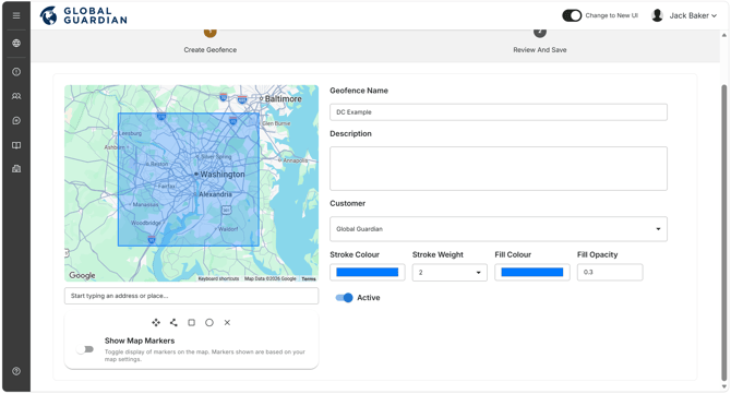
Create a Geofence
- Navigate to Administration and select "Geofences."
- Click "+ Add Geofence."
- Define the geofence area by selecting one of the available drawing tools:
- Polygon
- Rectangle
- Square
- Circle
- Draw the required boundary on the map.
- Select a color for the geofence.
- Enter a unique and descriptive Geofence Name.
- Optionally, add a Description.
- Select "Next."
- Click "Save Geofence."
The geofence is now created. You can then configure a Geofence Alert Rule.
Create a notification rule for Geofences, see this page.
Viewing Geofences on the Web Platform
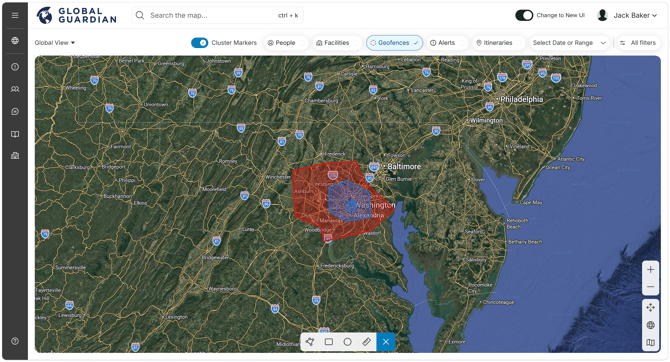
Geofences can be displayed directly on the interactive map by clicking "Geofences" on the primary map filter settings.
The geofence boundary will appear as an overlay alongside user location markers, making it easy to identify travelers who have checked in or are actively tracking within the defined area.